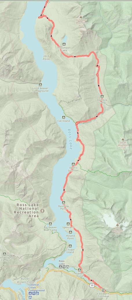
If snow or fire is preventing you from hiking Section L of the PCT, and you still want to hike from Highway 20 to the Canadian border, the Ross Lake route is the most common option.
If you hike the entire route from Highway 20 to the border, it is a little over 30 mies one way. There is 7,396 ft of elevation gain going northbound and 7,564 going southbound. Almost all of that elevation change is north of Lightning Creek, about 15 miles in. The high point of this route is Willow Lake Note the Ross Lake route is half the distance of Section L of the PCT. It starts 13 miles further north than Rainy Pass.
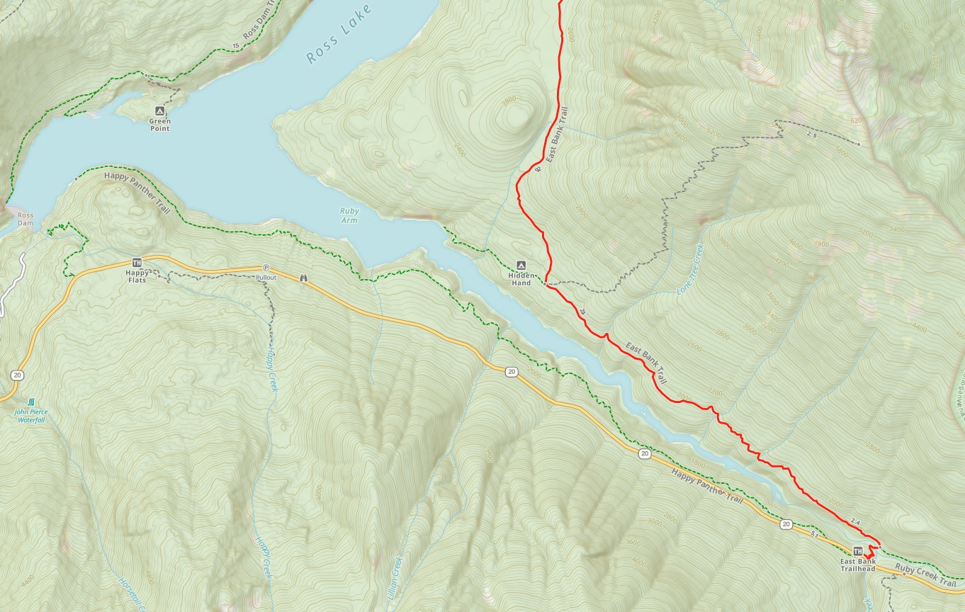
Have someone drop you off at The East Bank Trailhead at milepost 134. After you cross the Ruby Creek Bridge, hike west then north along the east side of Ross Lake.
If you need to send yourself a resupply package, you can send it to the Ross Lake Resort, ATTN: Jill Russell, [Hiker Name], [Expected pick up date], 503 Diablo St. Rockport, WA 98283
Option A
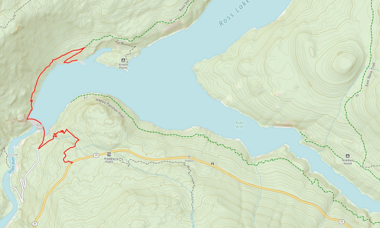
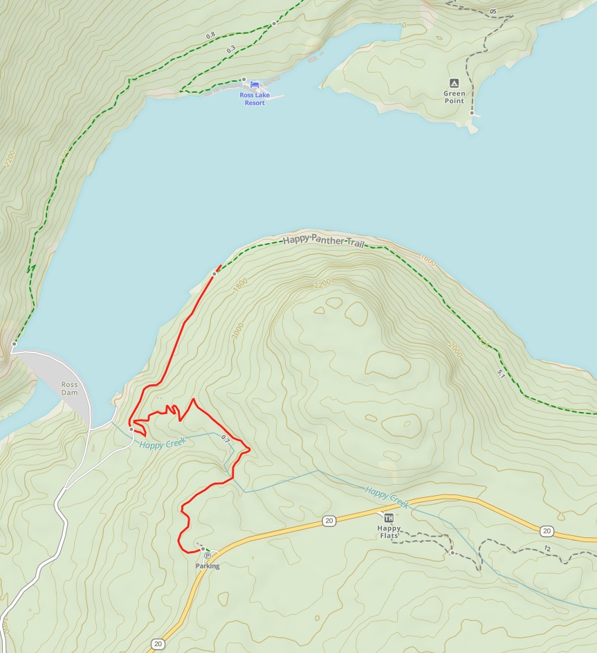
Option A - Have someone drop you off at the Ross Dam Trailhead , and hike across the Dam to the Ross Lake Resort. 653 ft elevation gain over 2.38 miles total.
Option B
Option B - Same as Option A but you hike a total of 1.02 miles to the dock directly across the lake from Ross Lake Resort and call for the water taxi. This is a reservation service that operates from 8 AM - 6 PM and is $3 per person each way.
The water taxi will drop you off at Hidden Hand Campground 1.85 miles from the resort. The fare is for the entire boat with capacity of up to 6 passengers. From there hike to Hidden Hand Pass and continue north to Canada. For a higher fee the water taxi will take you much further up the lake if you wish. Only you know if that is cheating or not.
Some people choose to hike to Canada, then take the water taxi the entire way back.