Exit / Entry Points on Section K
Summary: Stehekin, Suiattle and Union Gap are the three most common connections with Section K. Suiattle is closed due to fire. Sauk is your best alternative to Suiattle for connecting near Glacier Peak.
***18.3
miles from High Bridge Ranger Station to Rainy Pass trailhead on highway 20
with no exit points between them, permit required to camp in this stretch.***
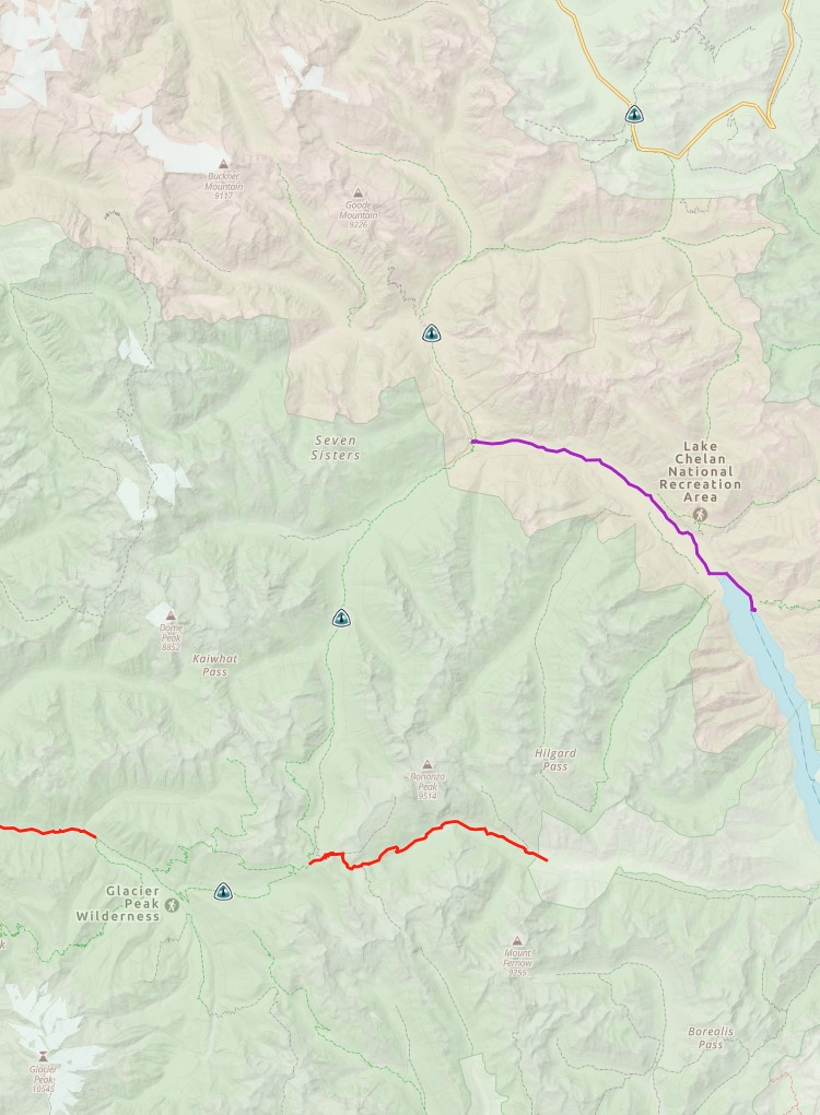
1. Stehekin Exit: Requires a ferry. Catch the red bus to Stehekin in front of the High Bridge Ranger Station, then take the Lake Chelan Ferry to Chelan.
2. Suiattle Pass / Cloudy Pass Exit: Requires a ferry. This 10 mile hike out begins with a 750 ft climb to Cloudy Pass, Trail ends at the Holden Ballpark Campground, then drive to Lucerne and catch the Lake Chelan Ferry to Chelan.
***28.6 miles between the
Suiattle bridge and High Bridge Ranger Station with no exit points between
them***
3. Suiattle River Exit: Suiattle River Trail #784 is still closed for the 2022 season. 6.46 mile hike down to Sulphur Creek Trailhead, then a 22.6 mile drive to State Route 530
4. Milk
Creek Exit: (not recommended) 5.59 mile hike down
to a deep river crossing on a rarely
used trail.
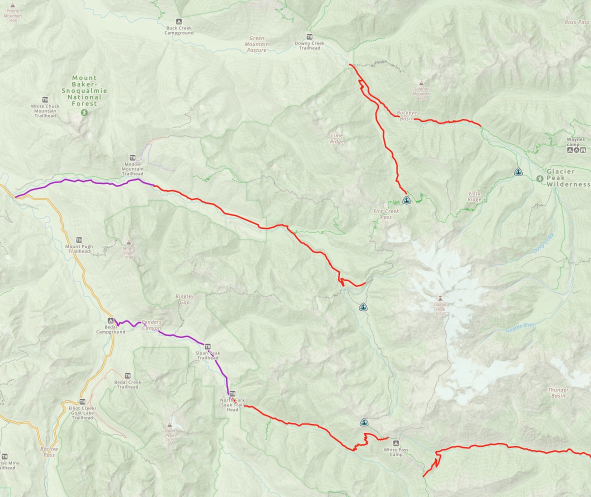
5. White Chuck River Exit: 10.6 mile hike down to NF-23, then a 5.72 mile drive to the Mountain Loop Highway CLOSED since the flood of 2003
6. Sauk River/ White Pass Exit: North Fork Sauk River Trail #649 is open for the 2022 season. 8.66 mile hike down to North Fork Sauk Trailhead on NF-49, then a 6.71 mile drive to the Mountain Loop Highway. Road conditions are pretty bad.
7. Reflection Pond / White River Exit: 14.2 mile hike down to White River Trailhead
8. Indian Pass Exit: 11 mile hike down to White River Trailhead
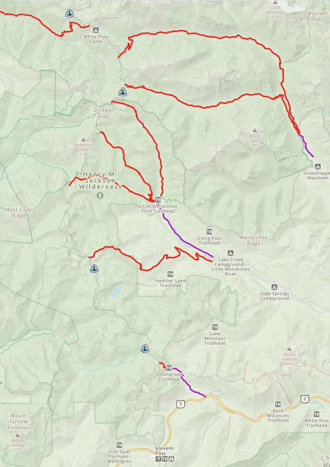
9. Sauk Pass/ Meander Meadow Pass Exit: 6.63 miles down to Little Wenatchee Ford Trailhead (see Caddy Pass Exit)
10. Cady Ridge Exit: Closed for 2022 season. 6.5 mile hike up 559 ft, then down to Little Wenatchee Ford Trailhead (see Caddy Pass Exit).
11. Cady Pass Exit: 4.84 miles hike up 587 ft, then down to Little Wenatchee Ford Trailhead (there is a footbridge over the river), 7.55 mile drive on a gravel road, then then 9 miles of dirt road, then 18 miles to Highway 2
12. Top Lake / Pear Lake Exit: 5.2 mile hike up 963 ft, then down to a logging road, then 9 miles of dirt road, then 16.6 miles to Highway 2.
13. Union Gap Exit: 1.23 mile hike down to Smithbrook Trailhead, then 2.72 mile drive on gravel Rainy Creek Road to Highway 2