Exit / Entrance Points on Section I
Section I, North Half, Snoqualmie Pass to Chinook Pass
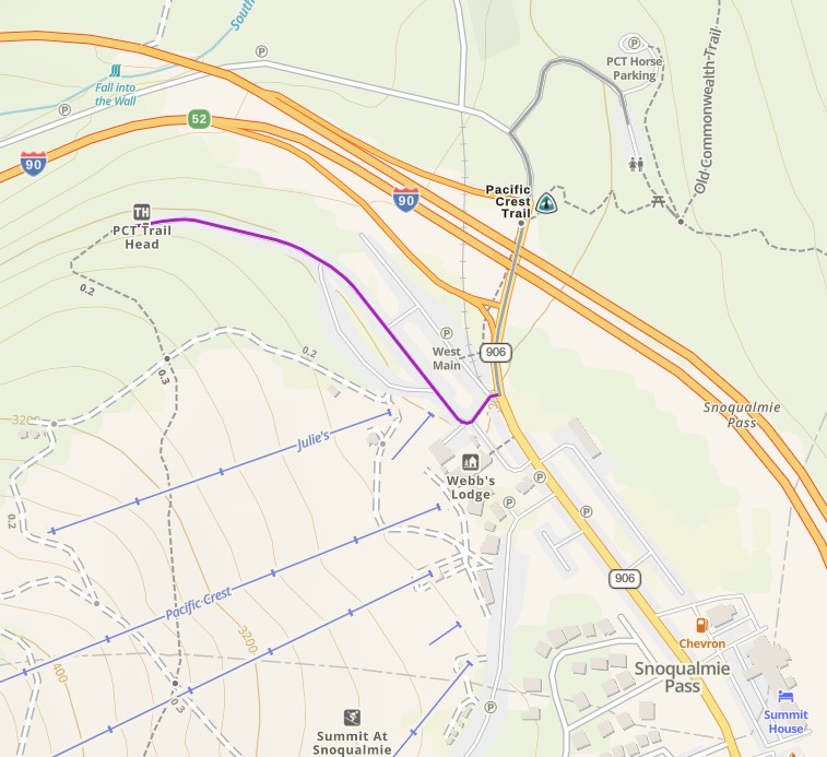
Exits that connect to Interstate 90
From Snoqualmie Pass to Tacoma Pass is less than 28 miles, so unless you have an emergency situation, your best bet for an exit is Stampede Pass because its one of the better maintained roads. Tacoma pass is the southernmost connection to Interstate 90, and I-90 itself is the northernmost connection with Section I.
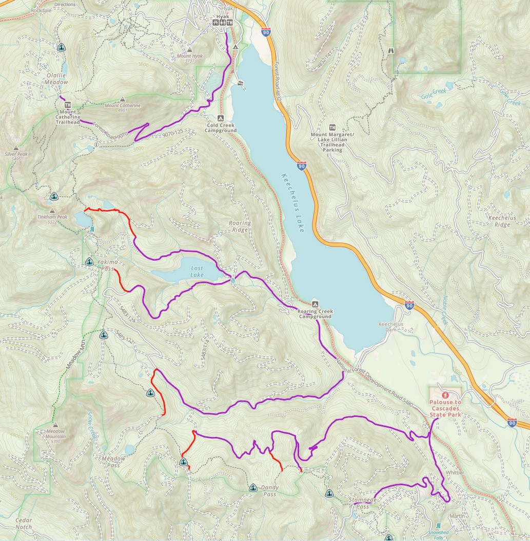
Fun fact: Yakima Pass was the primary route for horses before the Snoqualmie Pass road was constructed around the east side of Keechelus Lake thereby eliminating the need for a ferry ride on that route.
1). Olallie Meadow / "Windy Pass" Exit: No hiking, 4.66 mile drive on gravel road, then xx miles to Interstate 90
2). Mirror Lake Exit: 1.13 mile hike down to Mirror Lake Trail head, 4.5 mile drive on gravel road, then pavement.
3). Yakima Pass: (requires trail finding) Take a never-used 0.62 mile trail to FR-5480, then drive 2.32 miles on dirt road.
4). Road 5483 Exit: Less than 1 mile hike down to FR-5483, then 3.65 miles of dirt road.
5). Road 5484 Exits: There are three trails that connect the PCT to this road, all less than 0.75 miles long. Depending on which one you take, there is about 3.5 miles of dirt road to drive.
6). Stampede Pass: No hiking required, just a well-traveled 3.5 mile dirt road (FR-54)
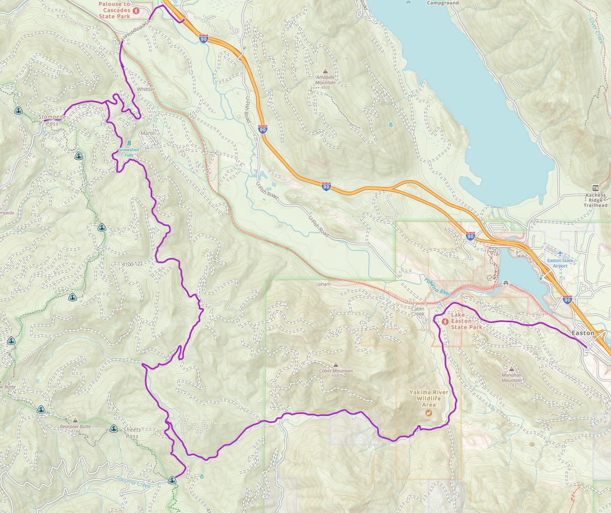
7). Tacoma Pass: No hiking required, 8.54 miles of dirt road (FR-41)
Exits That Connect to Highway 410
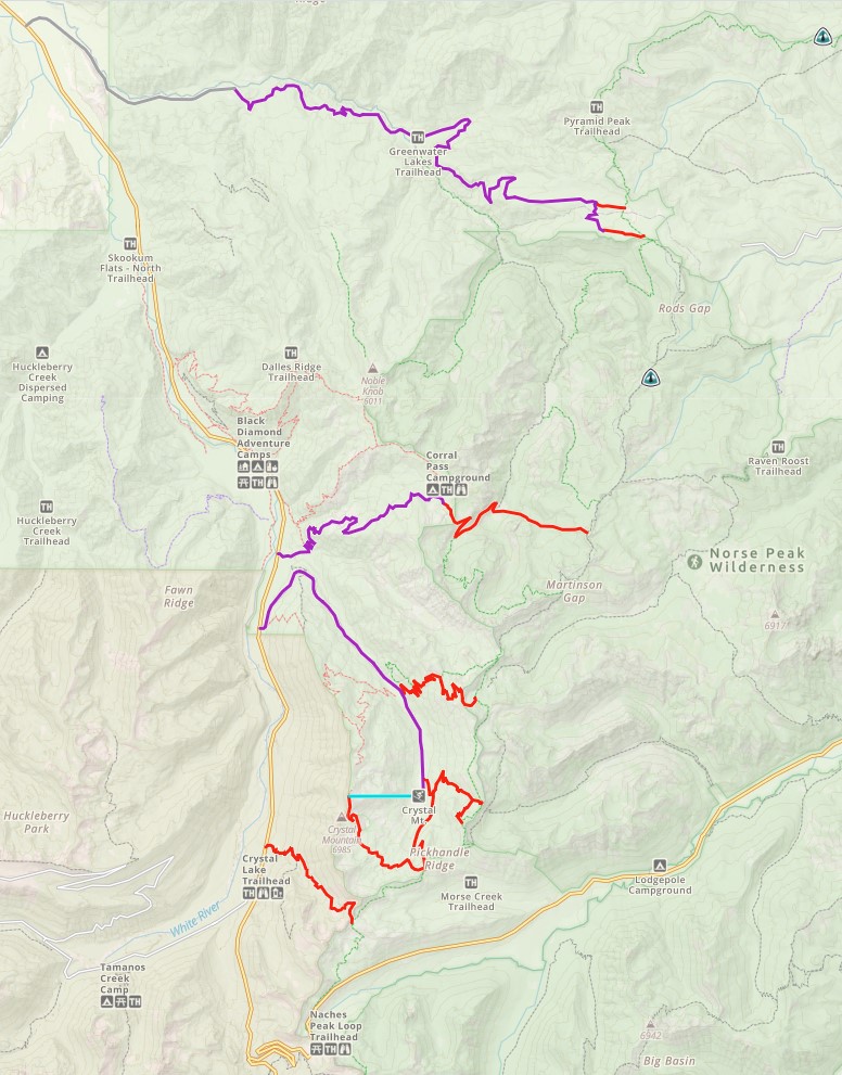
8.) Camp Mike Urich / Government Meadow Exit: 1/2 mile trail to Greenwater Road, then 11.5 miles of dirt road, then 4.58 miles to Greenwater, WA and Highway 410.
9). Corral Pass Exit: (steep rough dirt road) 4.23 mile hike with 1,635 e gain. Use the Tin Shack Tie Through Trail to connect with the Greenwater lakes Trail to the Corral pass Trailhead. Then a 5.84 drive down on Corral Pass Road to Highway 410
10). Barnard Saddle exit: 3.90 miles hike down to Halfmile Camp Trailhead on Crystal Mtn Boulevard. If you are nobo, the exit point below is a better choice.
11). Scout Pass / Norse Peak exit: 4.48 mile hike down to Halfmile Camp Trailhead on Crystal Mtn Boulevard. No dirt road. If you are sobo, the exit point above is a better choice.
12). Crystal Mtn Exit at Bullion Basin: There are two routes down to the Crystal Mtn Parking lot here, the shorter one is 2.21 miles. No dirt road.
You are only
7.78 miles away from Chinook Pass here, but with two high points to climb.
13). Crystal Mtn Exit at Bear Gap: a 2.06 hike down to the Crystal Mtn parking lot. No dirt road.
14). Crystal Mtn Exit at Bear Gap (Gondola option): 3.04 mile hike 654 ft down to the top of the Crystal Mtn Gondola. Then ride down.
15). Sourdough Gap Exit: 3.76 hike down to Crystal Lake Trailhead on Highway 410. No dirt road.
Its only 3.03 miles to Chinook Pass on the PCT from here,
all downhill.
Section I, South Half,
Chinook Pass to White Pass
This section is only 28 miles
long so departure anywhere other than Chinook Pass to White Pass seems only
needed in an emergency.
1). Chinook Pass Exit: Just north of where the PCT crosses over Highway 410 on a foot bridge.
2). American Lake exit: 6.12 miles down to near Bumping Lake. 5.83 miles of dirt road to Bumping Lake Campground. Then 11.2 miles of paved road to Highway 410.
It's only 6.41 miles to Chinook pass from here, but with
1,673 ft of e gain.
3). Cougar Lake exit: 7.76 miles " Starts with 743 ft of e gain, then all down. Same road access as the above route.
It's only 8.44 miles to Chinook pass from here, but with
2,041 ft of e gain.
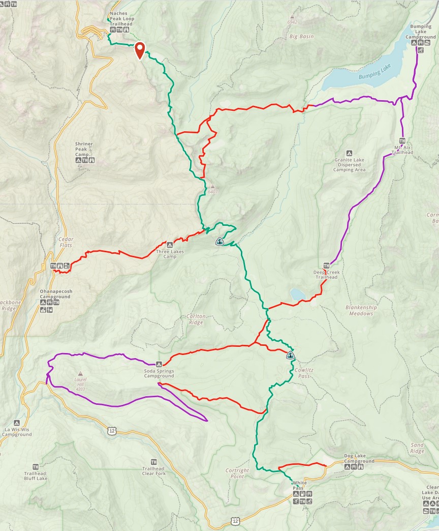
4). Three Lakes exit: 7.25 miles down to Highway 410. No dirt road.
5). Twin Sisters exit: 3.67 miles to Deep Creek Campground, Then 9.3 miles on dirt road to Bumping Lake Campground. Same road access as American Lake.
6). Snow Lake exit: 4.54 miles on Pot Hole Trail # 45, then Cowlitz Trail #44 to Soda Springs Campground, then 5.16 miles of dirt road to Highway 12.
7). Penoyer Lake exit: 0.5 miles longer than the above route but the better route for nobo. This one is all on Cowlitz Trail #44 to Soda Springs Campground
8) 4.24 miles on Cortright Trail down to FR-45 with a small 320 ft e gain at the beginning. Then 8.76 miles of dirt road to Highway 12.
Its only 4.5 miles downhill to White Pass from here so
this exit point does not make much sense.
9) 1.83 miles down to Dog Lake on Highway 12
This is more of an alternate than an exit because its
only 1.05 miles on the PCT to White Pass.
10). White Pass on Highway 12.